







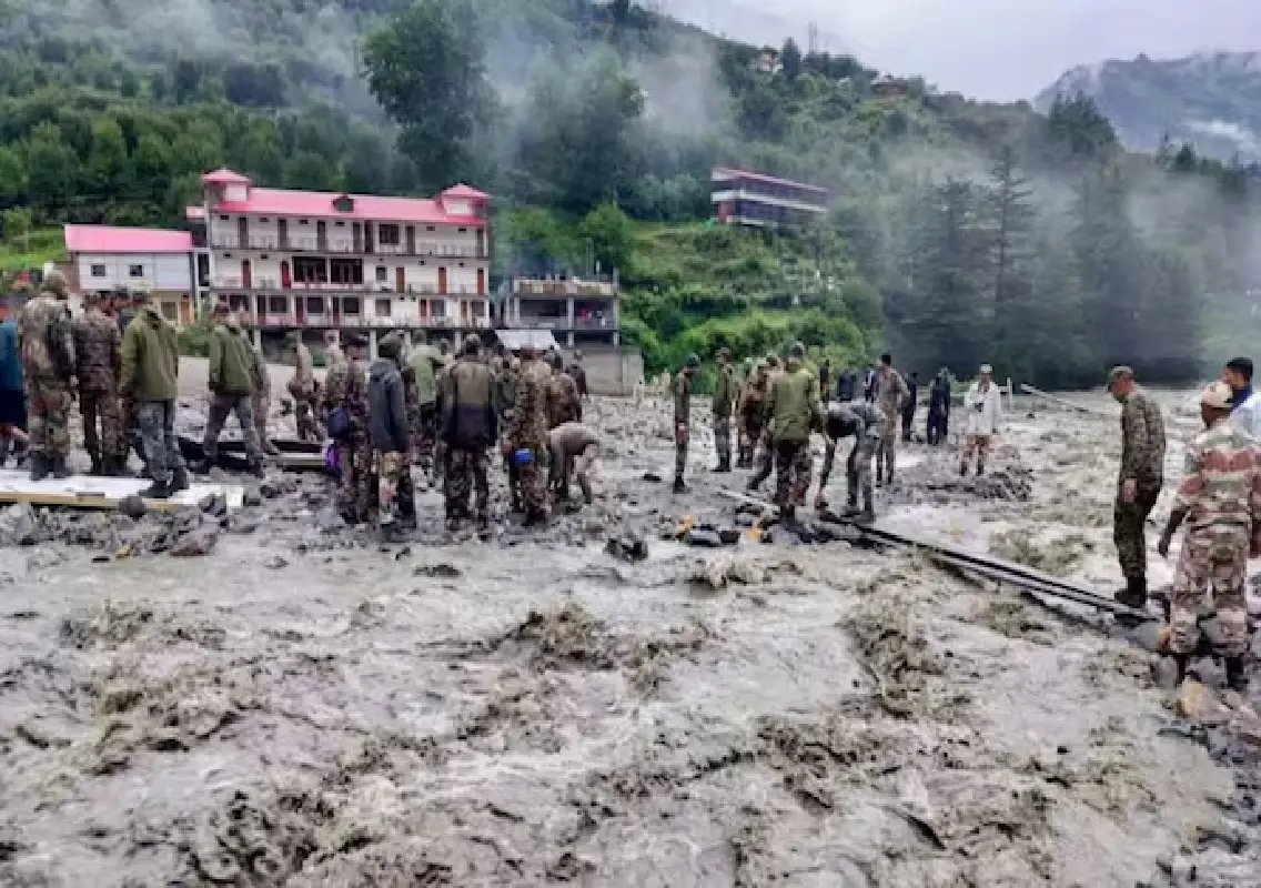


Dehradun: A devastating flash flood that struck the Himalayan town of Dharali in Uttarakhand on August 5, 2025, was not caused by a cloudburst as initially believed, but by the collapse of a massive ice patch on a glacier, according to a new study by the Indian Space Research Organisation (Isro).
The disaster, which triggered a sudden wall of water and debris rushing through the valley, had first been attributed to an intense and localised rainstorm — commonly known as a cloudburst. However, satellite analysis conducted by scientists from multiple Isro remote-sensing centres has revealed a different and more complex cause behind the catastrophic flood.
The findings, published in the scientific journal Natural Hazards, highlight a new and emerging threat in the Himalayan region where rapidly changing glacial landscapes are creating unpredictable hazards.
Ice patch collapse triggered the flood
According to the study, the flash flood began when a huge ice patch weighing nearly 69 million kilograms broke away from the Srikanta Glacier in the Garhwal Himalaya region of Uttarakhand.
The detached ice mass, located at an altitude of around 5,220 metres, was roughly equivalent in weight to about 400 blue whales.
Once the ice patch collapsed, it triggered a chain reaction of events. As the massive block of ice fell down the steep mountain terrain, it released enormous energy and destabilised the surrounding landscape.
The falling ice travelled nearly 1,700 metres down into the Kheer Gad channel, converting its gravitational potential energy into powerful kinetic force. The impact churned up rocks, boulders and loose sediment, creating a fast-moving mixture of water, mud and debris.
This slurry then rushed downstream at high speed and eventually struck Dharali, leaving residents with almost no time to respond to the sudden disaster.
Cloudburst theory debunked
Initially, many observers believed the flash flood had been triggered by a cloudburst — a phenomenon that is common in Himalayan regions and can cause sudden flooding.
However, the Isro study found no evidence of such extreme rainfall during the days leading up to the disaster.
Meteorological data showed that the region experienced only light to moderate rainfall between August 3 and August 5, which was insufficient to trigger the massive flood witnessed in Dharali.
This finding effectively debunked the widely circulated cloudburst explanation and shifted attention to glacial instability as the primary cause of the disaster.
Collapse occurred in a nivation zone
Scientists determined that the collapse occurred in what is known as a nivation zone — a high-altitude environment where persistent snow patches and buried ice gradually erode the surrounding terrain.
In such regions, ice layers can become dangerously thin and unstable over time.
The study revealed that the ice patch on the Srikanta Glacier had weakened significantly due to structural instability. Once the fragile section gave way, the entire mass collapsed and began its rapid descent down the steep mountain slope.
Researchers described the event as a cryo-hydrological disaster, meaning it was triggered by the sudden failure of cryospheric elements such as glaciers, ice patches or permafrost.
Rising risks from glacial instability
The Dharali incident highlights a growing concern among scientists studying the Himalayan ecosystem — the increasing instability of glaciers and ice formations due to deglaciation.
Deglaciation refers to the gradual loss or disappearance of ice in regions that were previously covered by glaciers.
As temperatures rise and glaciers shrink, smaller and thinner ice formations are left behind. These remnants are often unstable and prone to sudden collapse.
According to the Isro study, even relatively small ice patches — sometimes as thin as 30 centimetres — can trigger devastating disasters if they break off in steep mountainous terrain.
Such collapses can release enormous amounts of energy and set off destructive debris flows that travel rapidly through narrow valleys.
Need for improved early-warning systems
The discovery has important implications for disaster preparedness in the Himalayan region.
Traditional early-warning systems in mountain areas primarily focus on monitoring heavy rainfall, glacial lake outbursts and landslides.
However, the Dharali flood suggests that even small and seemingly harmless ice patches at high altitudes can become potential sources of catastrophic floods.
Scientists say monitoring efforts must now expand to include detailed observation of high-altitude snow and ice formations above vulnerable mountain settlements.
High-resolution satellite imagery, drone mapping and continuous remote sensing could play a crucial role in identifying unstable ice masses before they collapse.
A changing Himalayan landscape
Experts believe the Himalayas are undergoing rapid environmental changes due to climate warming and glacier retreat.
These changes are altering the region’s hydrological and geological stability, increasing the likelihood of sudden disasters such as flash floods, landslides and glacier collapses.
The Dharali event serves as a stark reminder that the threats facing Himalayan communities are evolving and becoming more complex.
Conclusion
The Isro study has provided critical insights into the true cause of the Dharali flash flood, revealing that the disaster was triggered not by a cloudburst but by the collapse of a massive ice patch on the Srikanta Glacier.
As glaciers continue to shrink and landscapes become increasingly unstable, scientists warn that similar cryo-hydrological hazards could become more common in the Himalayas.
Improving monitoring systems and strengthening early-warning mechanisms will be essential to protect vulnerable mountain communities from future disasters.