







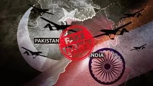


Pakistan’s claims surrounding a purported military campaign dubbed “Operation Sindoor” have been challenged after satellite imagery analysis contradicted Islamabad’s assertions of large-scale damage to Indian air bases.
According to open-source intelligence assessments and satellite images reviewed by independent analysts, Pakistan relied on doctored visuals and misleading narratives to claim that India carried out strikes on 11 air bases between May 8 and May 10, including strategically significant installations. The imagery, however, shows no evidence of runway damage, infrastructure destruction or operational disruption at the cited locations.
Satellite data contradicts strike narrative
The satellite images, taken before and after the alleged strike window, indicate that airfields, hangars and support infrastructure at the named Indian bases remained intact and fully operational. Analysts noted that some images circulated by Pakistani sources were either outdated, cropped selectively, or digitally altered to exaggerate impact.
Indian defence officials have not acknowledged any such strikes during the period, and independent imagery appears to reinforce New Delhi’s position that no damage occurred.
Misinformation campaign flagged
Security experts described the episode as a coordinated disinformation effort aimed at domestic and international audiences. By amplifying unverified visuals and dramatic claims, Pakistan sought to project a narrative of military parity and retaliation, analysts said.
“This is a textbook case of information warfare,” said one strategic affairs observer. “When kinetic action is absent or limited, narrative-building becomes the primary tool.”
Broader regional context
The episode comes amid heightened sensitivity in South Asia following earlier tensions between India and Pakistan. Experts warn that misinformation around military actions can escalate misunderstandings and complicate diplomatic channels.
India has repeatedly called for responsible communication and verification of claims, particularly when they concern military installations and regional security.
Call for verification and restraint
Analysts emphasised the growing role of commercial satellite imagery in countering propaganda. With high-resolution data increasingly accessible, exaggerated or false claims are more likely to be scrutinised and exposed.
As satellite evidence continues to circulate, Pakistan’s “Operation Sindoor” narrative appears to have lost credibility, underscoring the limits of misinformation in an era of transparent geospatial intelligence.