







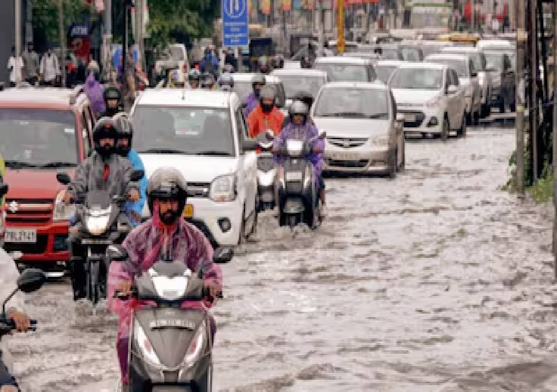


Bengaluru: Heavy rain returned to Bengaluru on Monday, October 5, causing waterlogging on several roads and underpasses, disrupting traffic and bringing down trees and branches in parts of the city. The spell came as rainfall activity intensified across Karnataka, with the India Meteorological Department (IMD) forecasting more rain and thunderstorms in several districts.
Bengaluru received 17.3 mm of rain between 3.30 pm and 5 pm on Monday, according to civic officials. The short but intense spell was enough to flood several low-lying roads and underpasses and cause traffic congestion across multiple parts of the city.
The weather is expected to remain active on Tuesday, with the IMD warning of heavy rain along with thunderstorms and lightning over parts of South Interior Karnataka.
Heavy rain causes waterlogging across Bengaluru
The Monday afternoon downpour affected several parts of Bengaluru, with water accumulating on roads and at key underpasses.
Hennur, Doddanekundi, Okalipuram, ITPL, Kasturinagar and Indiranagar were among the areas where waterlogging was reported. The Shivananda Circle and Hoodi underpasses also witnessed flooding following the rain.
Other locations affected included the road near Samhita Serenity Apartment in Doddanekundi, the Hebbal Flyover down ramp towards the airport, Rainbow Service Road towards Mahadevapura and the Kasturinagar down ramp towards Hebbal.
The Windsor Manor Bridge towards High Ground Junction and roads in Kodigehalli near Yelahanka also experienced water accumulation.
Although the water receded after the rain stopped, traffic remained affected for some time because of the disruption caused during the peak rainfall period.
Traffic hit in several parts of the city
The rain also resulted in traffic congestion on several important roads and junctions.
Traffic movement was affected towards Karthiknagar, Mahadevapura, 17th Main Road, Doopanahalli, Old Udaya TV Junction, Jayamahal, PG Halli Bus Stop and Aramane Cross.
Commuters also faced delays around CL Cross Cantonment, East Road, CBI Junction Flyover, Airport Road, Koramangala Inner Ring Road, Kuvempu Circle, Hebbal Circle, B Narayanapur and HBR Layout Main Road in Nagavara.
The combination of intense rain, waterlogged stretches and reduced road speeds resulted in longer travel times during the evening commute.
The disruption once again highlighted the vulnerability of several Bengaluru roads to intense short-duration rainfall, particularly in locations where drainage capacity is unable to cope with sudden inflows.
Trees and branches fall after downpour
The rain was also accompanied by strong winds and thunderstorms in parts of the city.
Officials reported that trees and branches fell in Indiranagar and HAL 2nd Stage. Civic teams were deployed to clear the fallen branches and restore road movement.
While no major casualties were reported in the civic assessment of Monday’s rainfall, falling branches and waterlogged roads created additional risks for motorists and pedestrians.
The IMD has warned that thunderstorms and lightning may accompany the next spell of rain, making caution necessary for commuters, particularly during intense weather periods.
Bengaluru receives significant rainfall
The rainfall was not limited to isolated pockets.
According to the IMD’s Bengaluru Met Centre, Bengaluru City recorded 42.6 mm of rainfall in the 24 hours ending at 8.30 am on October 6. Bengaluru GKVK recorded 65 mm, while HAL Airport recorded 20.1 mm and Kempegowda International Airport recorded 20 mm.
The figures indicate the uneven distribution of rainfall across the city, with some weather stations receiving considerably more rain than others.
The GKVK measurement of 65 mm was particularly notable, while the city station recorded more than 40 mm.
Elsewhere in Karnataka, Mysuru recorded 24 mm and Mangaluru 6.3 mm during the same observation period. Agumbe recorded 7.5 mm, while Gadag received 7.7 mm.
Heavy rain likely in three Karnataka districts
The IMD’s October 6 warning indicates that the most significant heavy-rain risk is currently concentrated in parts of South Interior Karnataka.
Chikkamagaluru, Hassan and Shivamogga districts are expected to receive heavy rain accompanied by thunderstorms and lightning at isolated locations.
Bengaluru Urban, Bengaluru Rural, Chamarajanagar, Chikkaballapur, Kodagu, Kolar, Mandya, Mysuru and Tumakuru are also expected to receive light to moderate rain with thunderstorms in some areas.
The forecast suggests that the rain-producing weather system is affecting a broad section of southern Karnataka rather than Bengaluru alone.
Coastal Karnataka may also receive rain
Coastal Karnataka is also expected to remain partly wet.
The October 6 forecast indicates moderate rain in parts of Dakshina Kannada, Udupi and Uttara Kannada. However, the IMD’s subdivision-wise warning currently shows no formal warning for Coastal Karnataka through October 12.
This means rainfall can continue in coastal districts even though the current warning level is different from that issued for South Interior Karnataka.
The continuing rainfall comes after several days of showers across the coastal belt and parts of the Malnad region.
Rainfall activity linked to wider weather system
The latest spell is part of a broader period of active weather over Karnataka.
The IMD had earlier forecast fairly widespread rain and thunderstorms over coastal and South Interior Karnataka during the first week of October. Meteorologists have also pointed to an active weather system developing over parts of the state.
The broader seasonal outlook suggests that Karnataka could receive near-normal rainfall during the October-December northeast monsoon period, particularly over South Interior Karnataka and coastal areas. The outlook is linked partly to Indian Ocean Dipole conditions, although scientists have cautioned that the IOD alone cannot determine the state’s eventual rainfall.
The current rainfall is therefore occurring during a period when several parts of Karnataka are transitioning into the post-monsoon and northeast monsoon season.
Civic agencies work on flood-prone locations
The latest waterlogging incidents have also renewed attention on Bengaluru’s recurring flood-prone locations.
Civic officials said some areas regularly experience flooding during heavy rainfall and that permanent solutions are being pursued.
Work around Geddalahalli has reportedly helped reduce flooding in Sai Layout and Vaddarapalya. Officials are also following up with the Railway Department on underpass-related work at Hoodi and Panathur to address recurring flooding problems.
However, the rapid accumulation of water during short, intense spells shows the continuing challenge faced by Bengaluru’s drainage infrastructure.
As the city continues to expand, rainfall runoff from built-up areas can quickly reach roads and low-lying locations, placing additional pressure on existing stormwater infrastructure.
More rain expected on Tuesday
The IMD’s current warning places South Interior Karnataka under a heavy-rain and thunderstorm warning for October 6. No warning is currently issued for October 7 onwards in the subdivision-wise forecast.
For Bengaluru, this means another spell of rain and thunderstorms remains possible, particularly as the active weather system continues to influence the region.
Commuters may therefore face further delays if intense showers coincide with peak traffic hours. Residents in low-lying areas and motorists using frequently waterlogged roads may need to exercise additional caution.
Conclusion
Bengaluru’s latest spell of heavy rain caused waterlogging, traffic disruption and fallen trees across several parts of the city, with 17.3 mm recorded during a two-hour period on Monday afternoon. The city recorded 42.6 mm in the 24 hours ending October 6 morning, while GKVK received 65 mm.
The IMD has forecast another active spell on October 6, with heavy rain and thunderstorms possible in parts of South Interior Karnataka. Chikkamagaluru, Hassan and Shivamogga face the possibility of isolated heavy rain, while Bengaluru and several neighbouring districts may receive thunderstorms and light to moderate showers.