Mangaluru: The region of Dakshina Kannada has been experiencing relentless rainfall over the past few days, leading the India Meteorological Department (IMD) to issue a red alert. In light of this, authorities have pinpointed 83 potential landslide sites as a preventive measure.
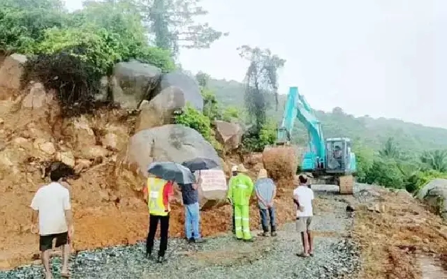
Satellite data indicate that 11 of these sites are particularly dangerous and could pose a significant threat to lives if landslides were to occur.

A survey by the Indian Geological Department attributes the increasing number of landslides to unscientific hill cutting for housing and road construction, soil erosion, and the creation of slopes by small water streams. Beltangady taluk has been identified as the most vulnerable, with 35 areas marked as landslide-prone. Four sites on Charmadi Ghat are categorized as highly dangerous, with an additional 16 spots posing a moderate risk and 13 considered low risk. The steep gradients in these areas significantly increase the likelihood of landslides.

In Bantwal, landslides are anticipated in B. Kasaba, Amtadi, Maninalkooru, Perne, Sajipamunnooru, Pudu, Sajipanadu, and Kariyangala villages, primarily due to hill cutting. The areas of Kaukradi and Ichlamapady in Puttur also face potential mudslides, a result of unscientific road extensions and excessive hill cutting.

In Sullia taluk, activities like summer soil removal and environmental degradation have heightened the risk of landslides in Sampaje, Arantodu, Todikana, Aletti, Markanja, Harihara Pallatadka, Balugodu, Kollamogru, and Kalmakaru.

Similarly, extensive construction and the resulting artificial pressure on the land have made Addoor, Muloor, Adyar, Arkula, Kenjaru, Soorinje, and Delantabettu in Mangaluru taluk more susceptible to landslides.

Dakshina Kannada Deputy Commissioner Mullai Mugilan has confirmed that high-risk areas have been identified and that necessary precautions are being implemented by the relevant officials. A report will be submitted to the government, recommending permanent measures to mitigate these risks.