


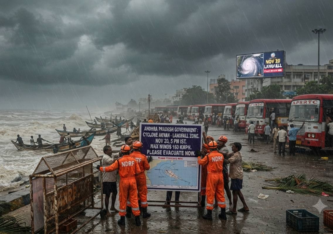


Amaravati: Andhra Pradesh is preparing for another powerful cyclone, with Cyclone Akvan expected to cross its coast on Friday, November 20. The approaching storm comes barely weeks after Cyclones Arnab and Murasu affected the state, making it the third successive cyclone system to threaten the Andhra coast within a short period.
According to the India Meteorological Department (IMD), Cyclone Akvan was moving north-northwestwards over the central and adjoining west-central Bay of Bengal. The weather system was forecast to intensify into a severe cyclonic storm by Tuesday evening and a very severe cyclonic storm by Thursday morning.
The IMD has projected that the cyclone is likely to cross the Andhra Pradesh coast between Nellore and Tuni around noon on Friday. At the time of landfall, it is expected to bring sustained wind speeds of 120-130 kmph, with gusts reaching up to 145 kmph.
The state government has begun preparations to deal with the potential impact, particularly in coastal districts expected to receive moderate to heavy rainfall on November 19 and 20.
Chandrababu Naidu reviews cyclone preparedness
Chief Minister Chandrababu Naidu reviewed the state’s preparedness at the Real Time Governance Society (RTGS) centre and directed officials to take advance measures to minimise the impact of the approaching cyclone.
The Chief Minister instructed authorities to deploy National Disaster Response Force (NDRF) and State Disaster Response Force (SDRF) teams in advance. Early deployment is intended to ensure that rescue and relief operations can begin quickly if the cyclone causes flooding, infrastructure damage or other emergencies.
Naidu also directed officials to strengthen arrangements for restoring electricity supply. Power infrastructure can be affected by strong winds and heavy rainfall, making advance planning important for reducing the duration of disruptions.
Managing excess floodwater was another key focus of the review. Officials have been asked to prepare for the movement and drainage of accumulated water, particularly in areas vulnerable to heavy rainfall and flooding.
The preparedness review comes as the state faces the possibility of another major weather event within weeks of two previous cyclones. The government is focusing on coordination among disaster response teams and departments responsible for power, transport and public infrastructure.
Seven coastal districts likely to receive heavy rainfall
The IMD forecast indicates that several coastal districts of Andhra Pradesh could experience moderate to heavy rainfall on November 19 and 20.
The districts identified as likely to receive significant rainfall include:
- Konaseema
- Kakinada
- East Godavari
- West Godavari
- Krishna
- NTR
- Guntur
The expected rainfall could create challenges in low-lying areas and locations already vulnerable to waterlogging. The government is therefore focusing on floodwater management and emergency response arrangements as the cyclone approaches.
The projected landfall between Nellore and Tuni places a considerable stretch of the Andhra Pradesh coastline under close watch. The intensity of the winds and rainfall will determine the extent of the impact on coastal communities and infrastructure.
Residents in the affected districts are likely to face weather-related disruptions as the system approaches. Authorities are preparing for possible emergency requirements, including evacuation and rescue operations if conditions deteriorate.
Cyclone Akvan follows two successive storms
Cyclone Akvan is the latest in a sequence of three cyclone systems affecting Andhra Pradesh within approximately three weeks.
The first was Cyclone Arnab, which crossed the Andhra Pradesh-Yanam coast near Narsapur on October 28 as a very severe cyclonic storm. It brought sustained winds of 125-135 kmph, with gusts reaching up to 150 kmph.
The storm was followed by Cyclone Murasu, which crossed the south Andhra coast near Ongole on November 3. It brought wind speeds of 100-110 kmph, with gusts reaching up to 120 kmph.
Murasu also triggered extremely heavy rainfall in parts of Coastal Andhra, adding to the weather-related challenges faced by the region.
With Akvan approaching, the state is preparing for another period of strong winds and heavy rain. The close timing of the three systems has raised concerns about the cumulative pressure on coastal communities, infrastructure and disaster management agencies.
Although the Bay of Bengal regularly experiences cyclones during this part of the year, three successive systems affecting the same coastline within weeks are considered unusual.
Why October to December is cyclone season
The October-December period is part of the post-monsoon cyclone season over the Bay of Bengal. During these months, atmospheric and oceanic conditions can support the formation and intensification of tropical weather systems.
A study covering the period from 1982 to 2022 found that nearly 65% of Bay of Bengal cyclones occurred during the post-monsoon season. This makes the period particularly important for weather monitoring and disaster preparedness along India’s eastern coastline.
However, the occurrence of three successive cyclone systems affecting Andhra Pradesh within a few weeks is not a routine pattern.
The state has experienced periods of closely spaced cyclones in the past. In November 2013, Cyclones Helen and Lehar made landfall just six days apart. Andhra Pradesh also witnessed three cyclones within a month in 1976 and 1987.
These historical events show that closely spaced cyclones are possible, even though they remain relatively unusual.
Andhra Pradesh’s history of cyclone landfalls
Andhra Pradesh has a long history of exposure to cyclones originating over the Bay of Bengal. According to the Andhra Pradesh State Disaster Management Authority (APSDMA), the state has recorded 151 cyclone landfalls since 1892.
Its extensive coastline makes the state vulnerable to storms that develop over the Bay of Bengal and move towards India’s eastern coast. Cyclones can bring destructive winds, intense rainfall, coastal flooding and damage to homes, roads, power lines and agricultural land.
The impact can extend beyond the immediate landfall area, depending on the storm’s size, movement and rainfall distribution.
The repeated cyclone activity in recent weeks has once again placed disaster preparedness at the centre of the state’s priorities. The government is relying on advance deployment of response teams, power restoration arrangements and floodwater management to prepare for Akvan.
State prepares for Friday’s expected landfall
Cyclone Akvan’s projected landfall on November 20 is being closely monitored by weather authorities and the Andhra Pradesh government. The forecast points to a very severe cyclonic storm, with sustained winds of 120-130 kmph and gusts of up to 145 kmph.
The coastal districts of Konaseema, Kakinada, East Godavari, West Godavari, Krishna, NTR and Guntur are among the areas expected to receive moderate to heavy rainfall on November 19 and 20.
With two previous cyclones having affected the state in a short period, the latest warning has prompted officials to prepare for another round of emergency response. The effectiveness of advance deployment, power restoration planning and flood management will be important in limiting disruption and protecting people in vulnerable areas.
The IMD’s forecast may be updated as the system develops, and residents should follow official weather bulletins and instructions issued by local authorities.