


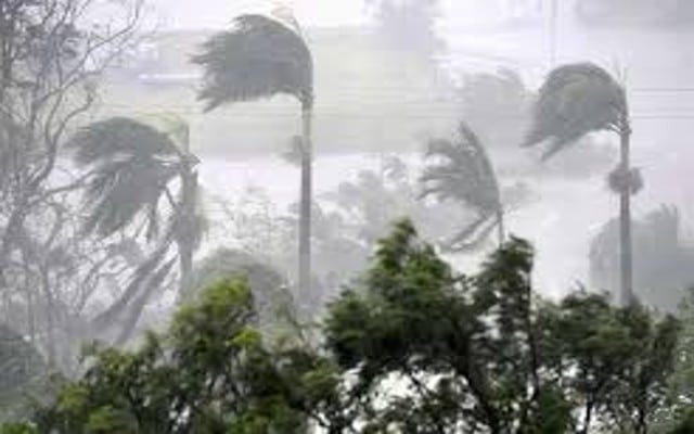
New Delhi: The wait for southwest monsoon might be a little longer for India with cyclonic storm Biparjoy developing in the Arabian Sea, met experts said on Wednesday.
The weather system is presently sustaining the strength of a very severe cyclone.
According to meteorologists, atmospheric conditions and cloud mass are indicating that the system is likely to sustain the strength of a very severe cyclone till June 12.
The India Meteorology Department (IMD) said the system is likely to be more organized and may intensify up to a very severe cyclonic storm by June 9.
“Weather conditions are very ripe for the system to continue to gain more strength. With long sea travel ahead, sea surface temperatures are very warm, infusing more heat and moisture into the atmosphere. This would help the system sustain its strength for a longer period,” said G.P. Sharma, President, Meteorology and Climate Change, Skymet Weather.
“The oceans have become warmer already on account of climate change. In fact, a recent study shows that the Arabian Sea has warmed up by almost 1.2-degree Celsius since March, thus conditions are very much favourable for the rapid intensification of the system so it has the potential to sustain the strength for a longer period,” added Raghu Murtugudde, professor, Department of Atmospheric and Oceanic Science, University of Maryland and IIT Bombay.
According to the report, ‘Changing status of tropical cyclones in the north Indian Ocean’, the frequency, duration and intensity of cyclones in the Arabian Sea have increased significantly. The intensity of cyclones has increased by about 20 percent (post-monsoon) and 40 percent (pre-monsoon). There has been a 52 per cent increase in the number of cyclones in the Arabian Sea, while very severe cyclones have increased by 150 percent.
Further, there has been an 80 percent increase in the total duration of cyclones in the Arabian Sea during the last two decades. The duration of very severe cyclones has increased by 260 percent.
The IMD predicted the onset of monsoon on June 4 with an error margin of plus/minus 4 percent.
The onset of monsoon over the landmass of Kerala is declared after meeting the three meteorological criteria. Rainfall over 60 percent of the given 14 stations in Kerala should be more than 2.5 mm for two consecutive days.
Secondly, the depth of westerly winds along with the value of outgoing longwave radiation (OLR), which is the energy emitted by the earth’s surface, oceans, and atmosphere into space should be below a certain value in the given area.
The IMD says the weather conditions are gradually becoming favorable for the onset of monsoon. All the required features are getting aligned. However, with cyclone Biparjoy brewing in the Arabian Sea, meteorologists have already warned against a thumping onset over Kerala.
“Looking at the location of the likely cyclonic storm, there are chances that the monsoon might make the onset around June 8-9, but it will not be a loud or strong one. Clouds and rainfall are the visible manifestation of the arrival of monsoon, which will be satisfied during the process of intensification of the cyclone. Hence, the onset will be there, but a subdued one. However, it would definitely be detrimental to the progress of the monsoon and the strengthening of the monsoon stream,” said Sharma.
Explaining the natural phenomenon, Roxy Mathew Koll, climate scientist, Indian Institute of Tropical Meteorology, and lead IPCC author, said an exceptionally warm Arabian Sea, a weak monsoon onset, and favourable Madden Julian Oscillation conditions in the Indian Ocean are favouring this cyclone.
“With this, it would not be the case of classic monsoon onset, satisfying all the given criteria. We would have scattered rains along the west coast strip but no inland penetration and widespread rains.”
Koll added, “We are presently witnessing weak monsoon winds, and under such circumstances a cyclone develops favourably in the Arabian Sea. If the southwest monsoon current is strong, winds blow in two directions — southwest in lower levels and northeast in upper levels. This would not allow the weather system to rise vertically and form into a cyclonic storm. However, when the monsoon is weak, the cyclone can develop vertically as it can cut through the winds and move upwards.”
Science blames climate change for increased cyclonic activity.
The increase in cyclone activity in the Arabian Sea is tightly linked to rising ocean temperatures and increased availability of moisture under global warming. The most recent example is Cyclone Mocha, which went up to the intensity of a very severe cyclone.
Cyclone Biparjoy has seen intensification even faster as it covered the journey from a cyclonic circulation (June 5) to a severe cyclonic storm in less than 48 hours (June 7).
According to experts, there has been an increase in the frequency of cyclones developing near the onset of monsoon, for instance, Cyclone Tauktae.
The rise in cyclogenesis, the development or strengthening of an area of low pressure in the atmosphere resulting in the formation of a cyclone, in the Indian Ocean has been the result of weakened monsoon circulation triggered by climate change.