


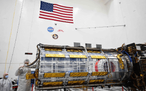
Jointly developed by the National Aeronautics and Space Administration (NASA) and the Indian Space Research Organisation (ISRO), an Earth-observation satellite, called NISAR was built by space agencies of the US and India under a partnership agreement signed in 2014. The 2,800 kg Satellite consists of both L-band and S-band synthetic aperture radar (SAR) instruments, which makes it a dual-frequency imaging radar Satellite.
What is NISAR and its mission?
Once launched into space, NISAR will provide critical information on Earth’s crust, ice sheets, and ecosystems, helping researchers better understand the causes and consequences of land surface changes.
Another important component of the satellite is its large 39-foot stationary antenna reflector. Made of a gold-plated wire mesh, the reflector will be used to focus “the radar signals emitted and received by the upward-facing feed on the instrument structure.”

It will spot warning signs of natural disasters, such as volcanic eruptions, earthquakes and landslides. The satellite will also measure groundwater levels, track flow rates of glaciers and ice sheets, and monitor the planet’s forest and agricultural regions, which can improve our understanding of carbon exchange.
ISRO will use NISAR for a variety of purposes including agricultural mapping, and monitoring of glaciers in the Himalayas, landslide-prone areas and changes in the coastline.
By using synthetic aperture radar (SAR), NISAR will produce high-resolution images. SAR is capable of penetrating clouds and can collect data day and night regardless of the weather conditions.