







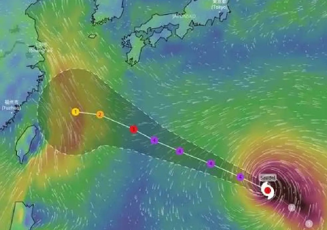


Tokyo/Taipei: Typhoon Saudel moved towards southern Japan and northern Taiwan on Tuesday, with authorities warning residents to prepare for heavy rain, powerful winds and dangerous sea conditions.
The medium-strength typhoon was travelling slowly at around 20 kmph, carrying maximum sustained winds of 162 kmph and gusts reaching up to 216 kmph. Japan’s weather agency warned of destructive gusts as the storm approached the southwestern Okinawa islands.
Japan braces for dangerous weather
Authorities in affected parts of Japan have urged residents to remain alert as Saudel could trigger landslides, flooding and rapidly rising rivers.
The storm’s slow movement could increase the amount of rainfall received in some areas, raising concerns over localised flooding and disruption. Strong winds and high waves are also expected around the Okinawa prefecture.
Taiwan faces fresh weather threat
Taiwan is also preparing for the typhoon, which is expected to pass north of the island before bringing heavy rain to northern areas from late Thursday into Friday.
The approaching storm comes as parts of southern and eastern Taiwan continue to deal with the effects of a separate tropical depression.
The Taiwanese government reported one death and four people missing after flooding affected Tainan and Kaohsiung. Together, the two cities are home to more than four million people.
Authorities urge caution
With two weather systems affecting Taiwan in quick succession, authorities are closely monitoring rainfall, river levels and flood-prone areas.
Residents in threatened regions have been advised to remain alert, follow official weather warnings and avoid unnecessary travel during periods of severe weather.
The storm is also expected to produce rough seas, creating additional risks for fishing communities, shipping and coastal areas.
As Saudel approaches, emergency agencies in Japan and Taiwan are preparing for potentially disruptive conditions, particularly in areas already vulnerable to flooding and landslides.